St James Conservation Area
Website
Ticket Information
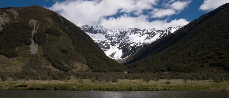
Exceptional natural features such as glaciated valleys, glacial moraine deposits, streams, wetlands, lakes and high altitude tarns, dominate the St James Conservation Area.
The Waiau River runs north to south through the St James Conservation Area. The western side, from Lewis Pass to the Waiau River is characterised more by mixed beech forests, open river flats, tussock tops rising to rocky snow mountain tops. In contrast, the eastern side is drier, open country with magagouri, exotic grasses, regenerating shrublands and mountain lakes.
Location:
Located on three mountain ranges and containing the headwaters of the Waiau and Clarence rivers, the St James Conservation Area encompasses the St James Walkway. The western side is 190 km from Christchurch - off Lewis Pass Road (SH 7) and the eastern side is accessed 13 km north from Hanmer Springs, off Tophouse road.
Image: DOC
Are you responsible for St James Conservation Area?
You can claim this venue to manage this listing's details.
Past events at St James Conservation Area
Log in / Sign up
Continuing confirms your acceptance of our terms of service.
Post a comment