NZ Cartographic Heritage: the land, the people, the stories
Online, Virtual
Ticket Information
Tour
Restrictions
Website
Listed by
This online visual tour of New Zealand government maps, with Cartographic Curator Igor Drecki, will provide you with the opportunity to discover them in a new light and appreciate the creative beauty of cartography
Turnbull Up Close online
Our Turnbull Up Close sessions are usually held onsite and give a small group of people the chance to get a special up-close introduction to some of the Library’s wonderful collections. COVID restrictions mean this isn’t possible this month, but instead we have an opportunity to take a closer look at part of the Library’s extensive collection of maps, online, with Curator Igor Drecki.
New Zealand Government maps
The collection of New Zealand government maps, collaboratively digitised by the National Library of New Zealand and the University of Auckland, provides a unique insight into the New Zealand cartographic heritage.
These authoritative maps of the country’s natural and social environment, together with maps of the South Pacific nations and Antarctica, have been produced by the Department of Lands and Survey (later called Department of Survey and Land Information, and recently Land Information New Zealand) since the 1870s. They cover a wide range of themes, from general, topographic and miscellaneous to aeronautical, mosaic and cadastral maps. The government also produced maps and charts for military and defence purposes.
Maps reveal fascinating stories
These maps reveal fascinating stories concerning land development, landscape changes, social trends and cultural events. They provide evidence of technological shift in map production, as well as in the advancement of cartography.
They tell human stories of the struggle for recognition and the pursuit of excellence. They are testimony to hundreds, possibly thousands of people that invested their talents and dedication to create them.
This visual tour of New Zealand government maps will provide you with the opportunity to discover them in a new light and appreciate the creative beauty of cartography
RSVP for a link to join this talk. We will send you a link to use on the day. Email ATLOutreach@dia.govt.nz.
This event will be delivered using Zoom. You do not need to install the software in order to attend, you can opt to instead run zoom from your browser.
About the speaker
Igor Drecki is Curator, Cartographic and Geospatial Collections at the Alexander Turnbull Library. Trained as a professional cartographer, he has worked in the private, local government and academic sectors before joining the Library. Cartography and maps have always been at heart of his professional pursuits.
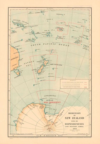
Image: Map titled Dominion of New Zealand with its dependencies (and Western Samoa), 1929


Log in / Sign up
Continuing confirms your acceptance of our terms of service.
Post a comment